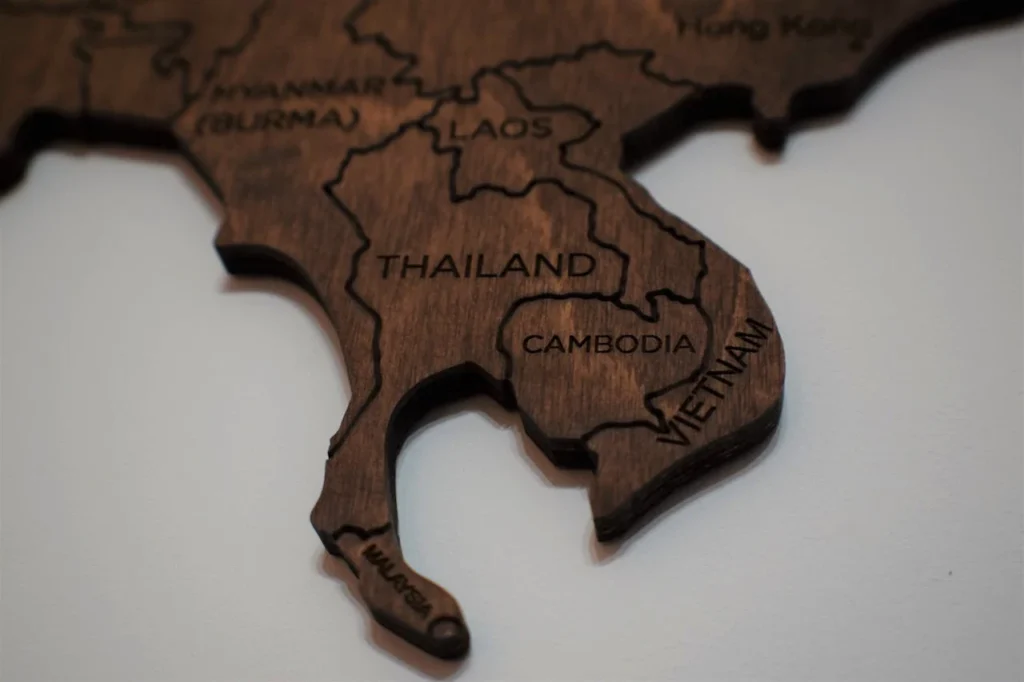

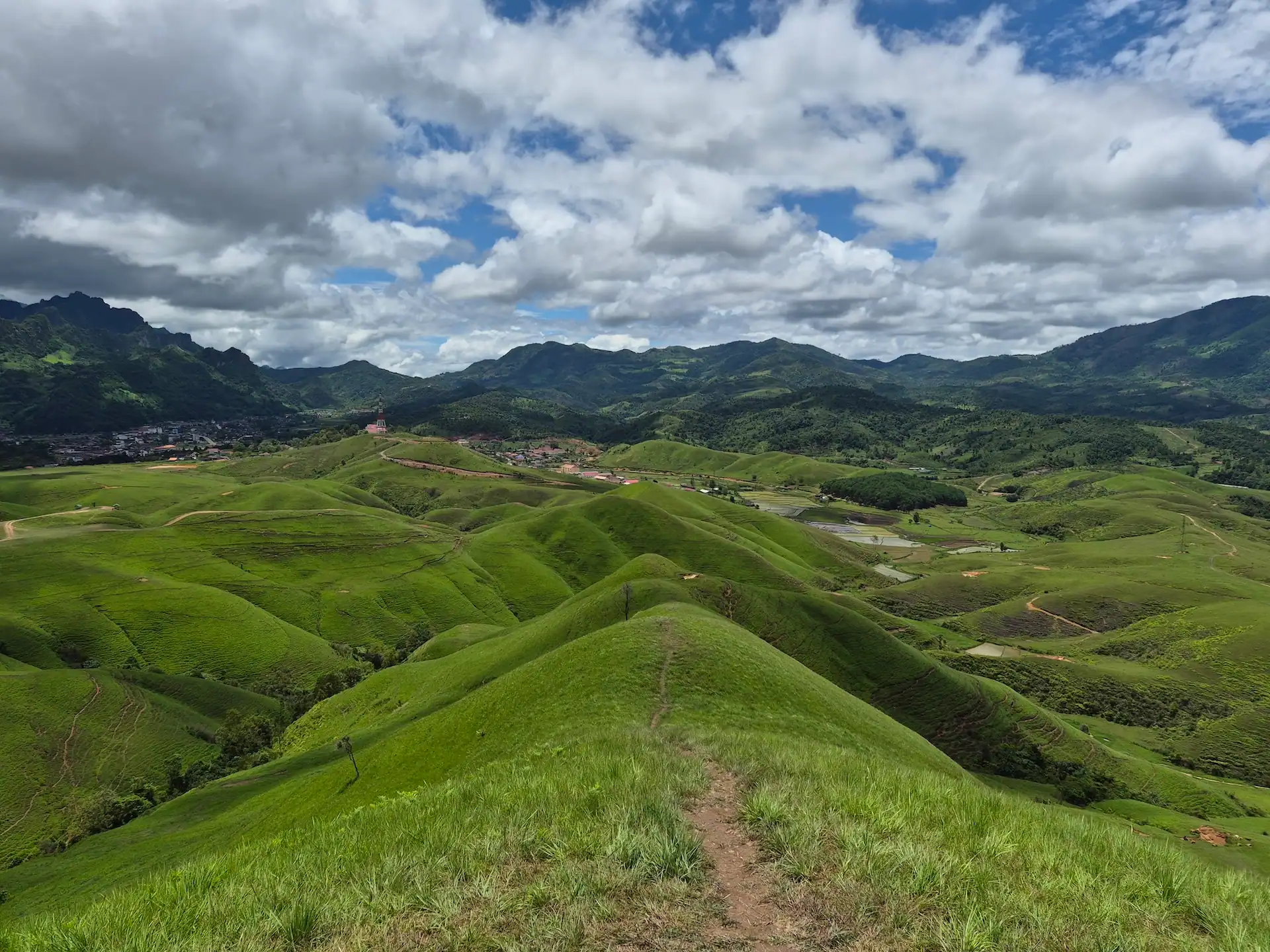
Reaching Phou Hua Lon with our own car felt like discovering a side of Laos that very few international travelers have ever experienced. The journey took us deep into the mountains of Laos’ Xaysomboun Province (sometimes written as Xaisomboun Province), far beyond the country’s familiar tourist routes. When the landscape finally opened up, endless grass-covered ridges appeared in front of us, with no crowds and barely a trace of tourist infrastructure in sight. It felt like uncovering a completely different Laos. But where exactly is that mysterious mountain range, sometimes referred to by locals as the “New Zealand of Laos“?
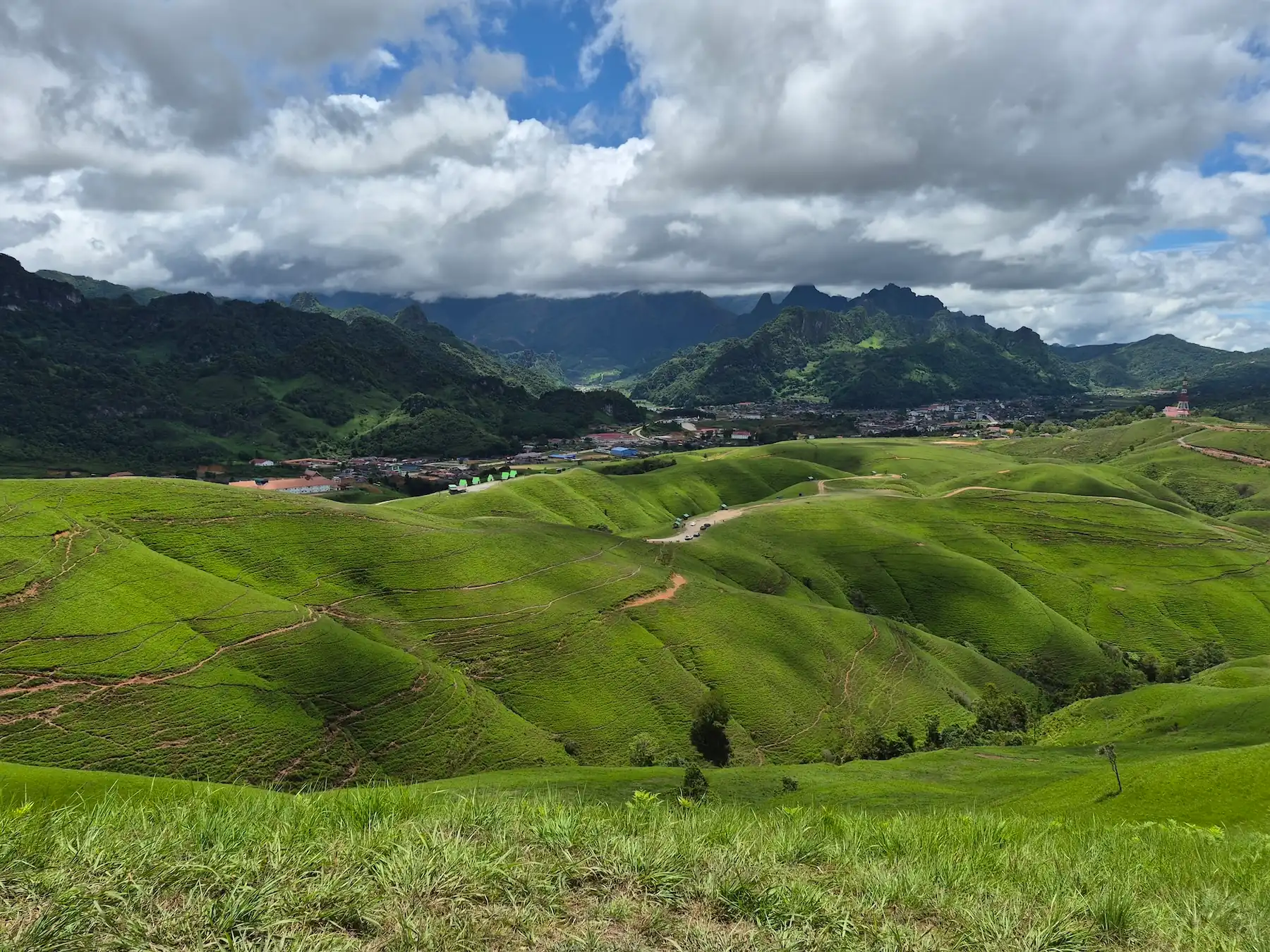
Phou Hua Lon is a largely treeless mountain landscape in the Anouvong District of Xaysomboun Province. It is known for its wide, rolling hills and stunning views across the surrounding valleys. It looks unlike almost anywhere else in Laos, where mountains are more commonly covered by dense forest or dramatic limestone formations.
Its Lao name, Phu Hua Lon (ພູຫົວໂລ້ນ), roughly translates to “Bald Head Mountain,” although it is usually shortened to “Bald Mountain” in English. The name describes the open, grass-covered slopes with very few large trees near the top.
Phou Hua Lon has become increasingly popular among Lao and Thai travelers and is now one of the country’s most photogenic mountain destinations. Despite this growing local popularity, it remains largely unknown to Western travelers. Most first-hand information is still shared in Lao or Thai, and the few English-language guides that exist rarely go beyond a handful of photos. This guide brings everything together: what we found on the ground, what we wish we’d known before heading up there, and everything you need to plan your own trip.
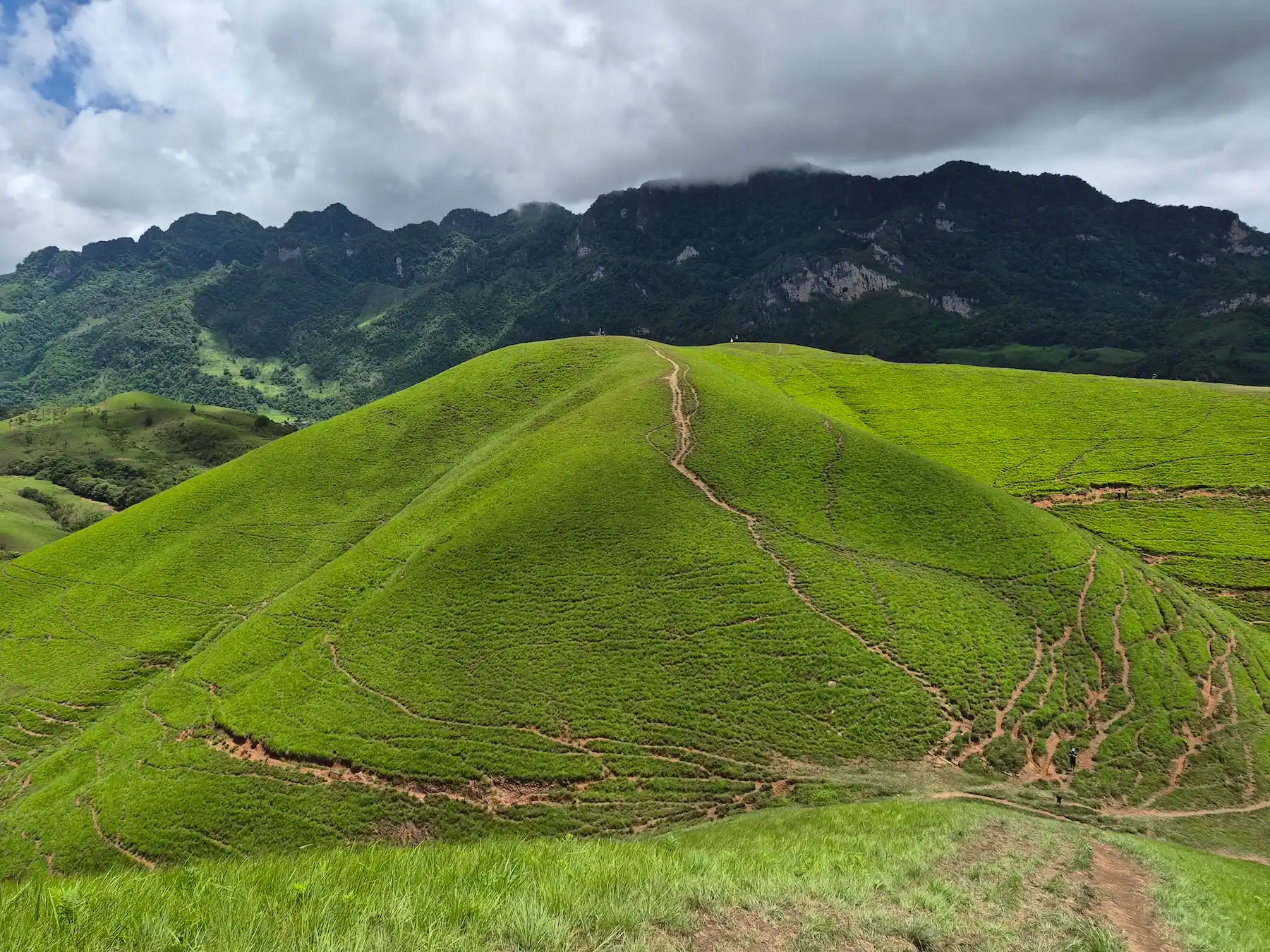
Phou Hua Lon Mountain sits in Anouvong District, Xaysomboun Province, roughly 220 km from Vientiane Capital, and takes around 5 to 6 hours to reach by road. Entrance costs 20,000 LAK (0,90 USD), and the best time to visit is between October and January, when the grasslands are still green but the roads are far more manageable than during the rainy season. Here’s a quick overview of everything you need to know before heading up to the Bald Mountain of Laos.
| Quick Fact | Details |
|---|---|
| Location | Anouvong District, Xaysomboun Province, Laos |
| Lao Name | ພູຫົວໂລ້ນ (Phou Hua Lon or Phu Hua Lon) |
| English Translation | Bald Head Mountain, commonly shortened to Bald Mountain |
| Approximate Elevation | Around 1,857 metres above sea level. |
| Distance from Vientiane | Approximately 220 km via Route 10 and the Phou Khao Khouay area. Allow around 5–6 hours depending on the route, weather and road conditions. |
| Road Conditions | Conditions depend heavily on your direction of travel and the season. Expect a combination of paved roads and rougher unpaved sections. Heavy rain can make parts of the route muddy, slippery and considerably slower. |
| Access and Hiking Time | Cars and motorbikes can reach the parking area below the main viewpoints. From there, you can walk between several grassy ridges and peaks. There is no fixed hiking time because you can decide how far you want to explore. |
| Entrance Fee | 20,000 LAK at the time of our last visit (June 2026) |
| Best Overall Time to Visit | October to January offers the best balance of green scenery, lower/no rainfall and more manageable road conditions. |
| Seasonal Breakdown | |
| May to September | The mountains are at their greenest, but frequent rain can make the drive and walking routes considerably more difficult. |
| January to April | Conditions are generally drier, but the grass gradually turns brown and visibility may be affected by smoke during the burning season. |
Visiting Phou Hua Lon aka. the Bald Head Mountain is nothing like an exhausting, multi-hour trek up. A sealed road runs all the way to the parking lot. Taking you from central Anouvong (Ban Mouang Cha) to the main viewpoint in just five to ten minutes. Step out of the car, and you’re immediately greeted by stunning 360-degree views across the surrounding highlands.
Entry costs 20,000 LAK per person, and refreshingly, there’s no dual-pricing here: locals and international visitors pay exactly the same (not like in a tourist-discriminating country like Thailand, where tourists pay 10-15 times more). A parking area sits right at the edge of the first major ridge, so you’re standing in the scenery within seconds of arriving.
From there, smooth green hills roll off into the distance, the kind of landscape people compare to Teletubby hills. There’s no fixed trail and no required route. You’re free to wander the narrow dirt paths along the ridgelines. And since most local day-trippers stick close to the parking area for quick photos, walking just ten to fifteen minutes further usually means having the ridges entirely to yourself.
Timing makes a real difference here. Get there around 6 am and you’ve got a good shot at catching a sea of clouds below you, with the bald peaks coming through the mist. Mid-day and late afternoon are nice too, just softer light and warmer colors on the slopes. Just know there’s zero shade up here. The elevation also means it can get windy and cool fast, so bring sun protection and a light jacket.
Simple bungalows are available directly on Phou Hua Lon for around 350,000 LAK per night. There are only a few units, and they cannot currently be booked online. You have to drive up and ask about availability in person, which is still common at smaller accommodations in Laos. Parking is available beside the bungalows.
Camping is also possible on the mountain, but bring your own equipment and confirm the current fee on arrival (not that expensive because it’s Laos after all). Staying overnight is the best option for experiencing sunset or sunrise, the cool mountain atmosphere and the early-morning mist. If everything is full, Anouvong (Ban Mouang Cha) is only around five to ten minutes away by car or motorbike. If you are riding a motorbike in Laos, please be careful as road conditions are not always good and Xaysomboun is a mountainous area.
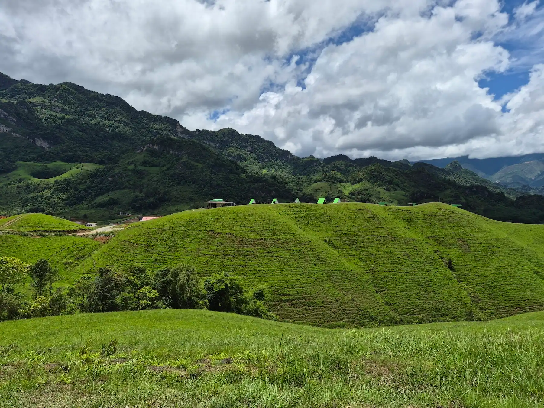
The best time of the year to visit Phou Hua Lon is from late October to January, when the hills are usually still green, rainfall is lower and the access road is easier to drive. As mentioned above, early morning is your best shot at mist between the peaks, while a clear afternoon gives you the widest views.
From May to September, the landscape is at its greenest because it is wet/rainy season, but heavy rain can make getting there considerably harder. Between February and April, conditions are drier, though the grass turns brown and smoke can reduce visibility (burning season). Our best time to visit Laos guide covers the country’s seasons in more detail with a monthly breakdown.
There is no airport, no railway station, and only limited public transportation running into Xaysomboun Province, which is exactly why not many (western) travelers make it out here to this remote province in Laos. Road conditions vary depending on your route and the season, so having your own vehicle (or private driver) is by far the most practical way in, but of course also the most expensive way.
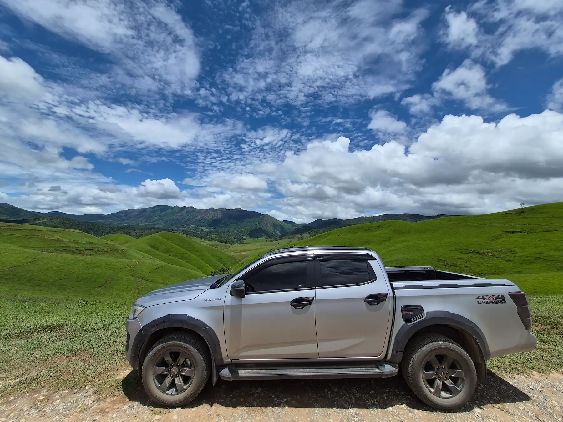
Choosing the right route matters just as much as having the right vehicle. Based on our own journey in June 2026, the best road from Vientiane or Paksan runs through Thabok and Phou Khao Khouay National Park, a drive of around 5 to 6 hours. The southern approach through Borikham and Thathom was in far worse condition when we drove it and should only be attempted with a proper 4WD-Vehicle.
Renting a car in Vientiane is the most practical way to explore Xaysomboun on your own. We drove our own pickup, and having that freedom made a big difference. Public transport is limited, and several places worth seeing sit outside Anouvong. You can compare rental cars in Vientiane on Trip.com, including cars available right from Wattay International Airport.
A normal car can handle the recommended route via Thabok in good weather. Still, an SUV or a car with higher clearance gives you more peace of mind, especially during the rainy season. Before you book, check that the rental company allows travel to Xaysomboun, and ask about their rules for unpaved roads, insurance and mileage limits.
From Vientiane, the journey covers roughly 220 km and takes around 5 to 6 hours (or more), depending on weather, road conditions and stops. Head east on Route 10 toward Thabok, then turn north onto the road that crosses Phou Khao Khouay National Park, and continues through the mountains into Anouvong District of Xaysomboun Province.
Route numbers on Lao roads aren’t always displayed consistently across navigation apps, so we’d treat Thabok as your real waypoint rather than relying purely on “Route 10” as a label.
As of June 2026, parts of the road inside Phou Khao Khouay were still unpaved because of ongoing roadworks. The unfinished sections had been graded though, and we found them noticeably more comfortable to drive than the rougher roads we hit further south.
Conditions can get rough after heavy rain, so build in extra time and avoid driving this stretch after dark. Download offline maps before leaving Vientiane, since mobile coverage in the mountains can’t be relied on.
For most self-drivers coming from Vientiane, this is currently the route we’d recommend. This route is also reliably available on Google Maps.
Travelers arriving from southern Laos will normally reach Paksan on Route 13 after passing through Savannakhet and Thakhek. From there, Google Maps often suggest continuing inland through Borikham and Thathom, but we’d strongly advise against it.
We actually tested both routes on the same trip: we drove in via Thathom and back out to Vientiane via Thabok, which gave us a direct comparison. The Thathom route was in an extremely poor state, with large sections severely degraded, deep ruts and rocky roads that made progress very slow. To make things harder, Google Maps didn’t show the correct route at all, and we had to stop and ask locals for directions several times along the way. A 4×4 pickup is essentially required here, and it’s not a road we’d recommend attempting in a standard passenger car, especially during the rainy season.
The better option, even coming from Paksan, is a slight detour west to Thabok and then into Xaysomboun Province via Phou Khao Khouay, the same route we detailed above. It adds some distance, but the road was considerably more manageable, and unlike the Thathom route, navigation actually worked reliably.
If you don’t have your own vehicle, local buses and shared minivans do run between Paksan and Anouvong, though reliable schedules are hard to find online. Your best bet is asking directly at the bus station and confirming the departure before planning the rest of your day.
Xaysomboun can also be reached from Phonsavan in Xieng Khouang Province, which makes it easy to combine Phou Hua Lon after a visit to the Plain of Jars.
One traveler on Reddit reported a direct bus from Phonsavan South Bus Terminal to Xaysomboun Bus Terminal in November 2025, departing at 8:00 am, costing 160,000 LAK and taking around six hours, with a ride described as comfortable and genuinely scenic. Other travelers familiar with the road, though, reported seeing very little regular public transport along the full route, so we wouldn’t treat this as a guaranteed daily service. Your best move is to show up at Phonsavan South Bus Terminal a day ahead, confirm the current departure time, and reserve a seat if the bus is running.
If you’re driving yourself, expect a rougher, narrower section starting around 25 km south of Muang Khoun and continuing toward the provincial border. A driver who regularly travels between Phonsavan and Anouvong described this stretch as rocky. Take it slow and avoid tackling this section after dark.
When you look at Google Maps, the approach from Vang Vieng through Tha Heua and across Nam Ngum 2 Reservoir looks like a shortcut into Xaysomboun Province. Google Maps will happily suggest it, too. In practice, this route means loading your vehicle onto a local ferry to cross the reservoir, and even the road leading down to the pier is in poor condition, so reaching the ferry is its own small adventure before you’ve crossed anything.
Both cars and motorbikes can use the crossing, but it shouldn’t be treated as a predictable shortcut. Departure times aren’t fixed, the correct pier can be hard to find, and waiting for enough passengers or vehicles to show up can add several hours to your journey.
Lao travel creator NatNomad documented this exact crossing during a motorcycle trip between Xaysomboun and Vang Vieng, and his video is the most detailed first-hand account of the route we could find. It shows two separate departure points, with no clear signage explaining which pier travelers actually need.
The larger ferry takes cars, trucks and passengers. According to what NatNomad was told during his trip, it waits until enough passengers and vehicles arrive to cover the operating cost, which meant a departure delayed until 4 or 5 pm on the day he crossed. A smaller boat handles motorbikes only, and on his journey it was expected to leave around 12:30 pm instead. He also got lost twice just trying to find the right pier, which says a lot about how hard this crossing is to navigate without local help.
These times reflect one documented journey, not a fixed daily schedule, so treat them as a rough indication rather than a timetable you can plan around.
On NatNomad’s crossing, the boat took roughly three hours and cost 300,000 LAK for one traveler with a motorbike, including a 30-minute delay after a steering cable snapped mid-crossing. That’s not the norm, but it shows why you shouldn’t plan a tight itinerary around this ferry. Fares, timing and duration all shift with season, water level and demand, so confirm locally before attempting the crossing. Expect to pay much more for the ferry if you are traveling by car.
For adventurous motorcyclists, this crossing can be an unforgettable, genuinely rare overland experience. For anyone driving a car who just wants to reach Phou Hua Lon efficiently, we’d skip it. Cars take up far more space on the boat, and an unpredictable departure can turn a shortcut into a half-day wait. Use the route via Thabok and Phou Khao Khouay National Park instead, as described above.
For a realistic look at the road, the poorly marked piers, loading the boat, and the three-hour crossing itself, NatNomad’s video says more than any description can. The ferry section starts at around 12:08.
Yes and no. You can reach Anouvong or the Province Capital Ban Mouang Cha (= Mueang Anouvong) by local bus or shared minivan, but public transport doesn’t normally take you all the way to the Phou Hua Lon parking area itself.
As mentioned above, timetables for this route are unreliable at best, so the same rule applies here: check locally, stay flexible, and don’t lock your itinerary around a fixed departure time, it’s Laos after all and things are very flexible (Please don’t rush).
Once you’ve made it to Anouvong, you’ll still need to arrange the final leg to Phou Hua Lon. Depending on what’s available when you arrive, that usually means hiring a local driver, arranging a transfer through your accommodation, or renting a motorbike for the day. But once you are there, that’s the easy part because the Trailhead of the Bald Head Mountain is just a few minutes outside of town.
Still not sure which route fits your starting point? Here’s the short version: a side-by-side comparison of every route covered above, with our honest verdict on each one.
| Starting Point | Route or Transport | Conditions | Recommended Vehicle | Our Verdict |
|---|---|---|---|---|
| Vientiane / Paksan | Via Thabok and Phou Khao Khouay National Park | Partly unpaved but graded and reasonably easy to drive during our visit in June 2026 | Car, SUV or suitable motorbike, depending on the season | Best overall route |
| Paksan | Inland route via Borikham and Thathom | Poor and difficult during our visit in June 2026, especially after rain | 4WD/4X4 Vehicle | Not recommended |
| Phonsavan (public bus) | Reported direct bus from Phonsavan South Bus Terminal to Xaysomboun Bus Terminal | Approximately 6 hours and 160,000 LAK according to a traveler report from November 2025 | Public bus | Confirm the current departure locally |
| Vang Vieng | Via Tha Heua and the ferry across Nam Ngum 2 Reservoir | Unpredictable departure times, limited signage and a crossing that can take several hours | Motorbike or adventure prepared vehicle | Only for adventurous travelers |
Xaysomboun Province, also someteimes written as Xaisomboun Province, is the youngest and one of the least visited provinces in Laos. It was officially established on 13 December 2013 as the country’s 18th province, covering approximately 8,300 square kilometres. The province consists of five districts: Anouvong, Long Cheng, Tha Thom, Long San and Hom. Its provincial capital is Anouvong, the town most travelers pass through on their way to Phou Hua Lon.
According to the official Tourism Laos overview of Xaysomboun Province, the province had a population of just over 95,000 in 2025, with Hmong communities forming the largest ethnic group. Beyond the main towns, the landscape is dominated by steep valleys, high mountains, remote villages and large areas of jungle vegetation. The cooler climate and rugged geography make Xaysomboun feel noticeably different from the lowlands around Vientiane and the Mekong River.
Tourism infrastructure remains limited, but that’s also part of what makes traveling through Xaysomboun so fascinating. Roads are gradually being improved, new mountain destinations are appearing online, and Lao travel creators are increasingly sharing places that remain almost unknown outside the country. Phou Hua Lon is one of the clearest examples: already popular with Lao and Thai visitors, yet still largely unknown to western tourists.
Xaysomboun also played a central role in one of the most complex chapters of modern Lao history. During the Laotian Civil War, often called the Secret War, Long Tieng became the main base of the Hmong General Vang Pao and the Hmong forces backed by the United States. Contrary to how it’s sometimes described, this was never a conventional US Army base. Long Tieng instead functioned as a secret, CIA-supported airfield and military operations center, built deep inside the mountains and left off most maps of the time.
The CIA trained, equipped and supported indigenous forces, many of them ethnic Hmong, who fought against North Vietnamese and Pathet Lao troops. A declassified CIA history of air operations in Laos records that the Hmong army was headquartered in the Long Tieng valley, and that roughly 20,000 Hmong fighters had already been armed by the end of 1963. Air America aircraft used the mountain airfield throughout the conflict to move soldiers, supplies and refugees in and out of the region (Source: Studies in Intelligence Winter, CIA Air Operations in Laos, 1999-2000, William M. Leary).
At its peak, Long Tieng grew into a settlement of tens of thousands of people while officially not existing on paper. Known during the war as Lima Site 20A, the airfield became one of the busiest in the region, despite its secrecy. Today, the area is commonly known as Long Cheng and remains one of the most historically significant places in Xaysomboun Province.
Xaysomboun Province is also home to Phou Bia, sometimes written Phu Bia, the highest mountain in Laos at approximately 2,820 metres. The mountain sits among the steep valleys, remote forests and rugged terrain, and Tourism Laos also highlights its biodiversity, including Fokienia trees growing in the surrounding valleys.
For years, Phou Bia was extremely difficult for travelers to reach. That began to change in 2023, when a local developer announced plans for an access road a resort, aiming to open the mountain to both Lao and international visitors, though we couldn’t confirm that every part of that plan was actually completed. Either way, Phou Bia has never been a simple, independent hike with guaranteed access, and reliable information on opening dates, road conditions or booking is still hard to find online. Before planning a visit, confirm the current situation directly with the Xaysomboun provincial authorities or the site operator. You can get a permit to visit from them. A road is partly being completed already.
Elevation isn’t the only reason Phou Bia is hard to access. Xaysomboun was heavily affected by the fighting around the Secret War, and unexploded ordnance (UXO) is still a concern in parts of the province. Phu Bia Mining itself notes that remoteness and UXO in its exploration areas make fieldwork potentially dangerous. That doesn’t mean every road near Phou Bia is contaminated, but stick to approved roads and trails, stay out of unmarked forest, and never touch unfamiliar metal objects.
The area has also stayed politically sensitive since the war. Small anti-government groups reportedly remained active in some remote mountains after the conflict ended, which is part of why Xaysomboun still shows up in foreign travel advisories, and why you’ll occasionally see a military presence or road checks. The most recent documented incident was a clash between government troops and an unidentified armed group in Thathom District on 9 March 2021, reported by Radio Free Asia, after which the district temporarily closed the affected area. Open Development Mekong has linked some of these tensions to disputes over land and development projects, though these claims are hard to verify independently.
It’s worth putting this in perspective, though: Xaysomboun is a large, mountainous province, and an isolated incident in remote Thathom District says very little about what you’ll actually encounter in Anouvong or at Phou Hua Lon. We drove through the province in June 2026, stayed in Anouvong and visited Phou Hua Lon, and the whole trip felt calm and completely normal. No checkpoints hassle, no tension, nothing that made us feel unsafe as foreign travelers.
For an ordinary visit to Anouvong and Phou Hua Lon, though, the reality on the ground felt far more relaxed than the international travel warnings might suggest. Therefore we can’t confirm the completely exaggerated travel advices by some foreign governments, such as US and UK. It is way more dangerous in the US and UK, than anywhere in Laos!
Normally, yes it is possible to visit Laos’ highest mountain, but it’s not a simple walk-up hike. A road leads part of the way up, but visitors need permission from the authorities in Anouvong and are typically accompanied by a local official or guide. If you don’t speak Lao or Thai, best is to ask your guesthouse staff how to get the permit for Phou Bia.
Right now, in September 2026 and in general during rainy season, access to Phou Bia is suspended after heavy rainfall damaged the route. Once it reopens, November to February should offer the best conditions. Our best time to visit Laos guide covers the country’s seasons, weather and road conditions in more detail.
Phou Hua Lon is probably the main reason people come here, but it’s not the only reason. In our opinion, Xaysomboun is the most beautiful province we’ve seen in Laos so far. It’s mountainous, very quiet, and so spread out that every drive feels like part of the trip. Roads are empty too.
Most people in Xaysomboun are Hmong, and many of the remote mountain villages here are Hmong communities. They have their own language and keep their own traditions, clothing and festivals alive, which you’ll notice as soon as you drive through.
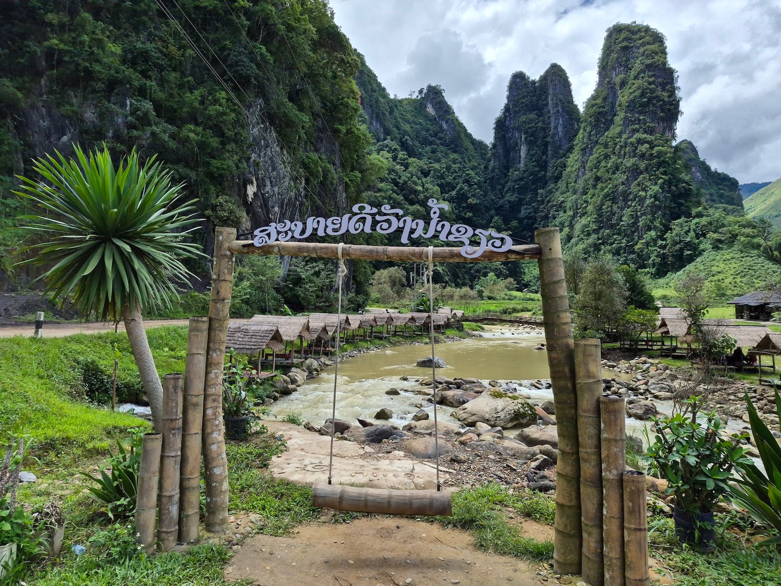
Wang Nam Kiew, sometimes spelled Wang Nam Khiaw, is a great spot for lunch near Anouvong. It’s a riverside restaurant with small bamboo huts built right over the water. The water is exceptionally clear (during the right season), and the setting is calm and green, perfect for a lunch break after a morning at Phou Hua Lon.
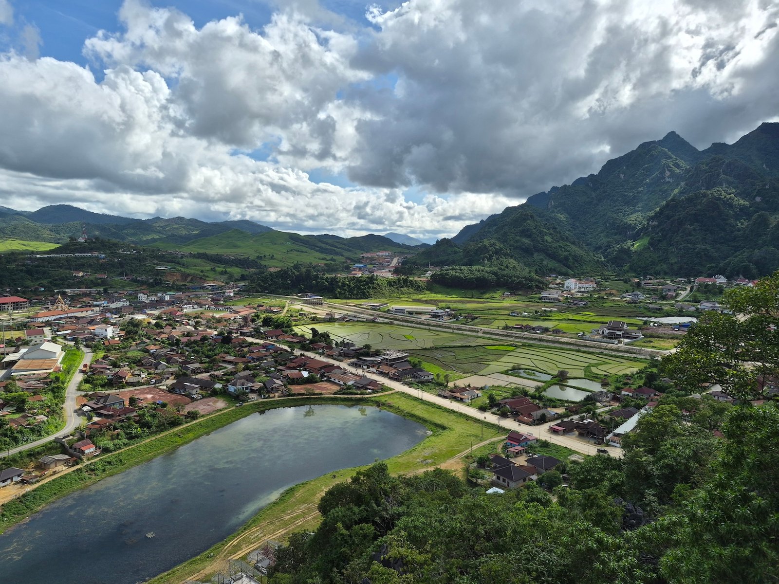
For one of the best views over Anouvong, climb up to Neng Ye Lor Viewpoint. You can park next to a house near the start of the trail. The climb takes about 15 to 20 minutes. It’s steep in a few places and has some wooden ladders near the top, but it’s easy enough with proper shoes.
During our visit in June 2026, parking cost 5,000 LAK and entrance was 10,000 LAK per person. From the top, you get a wide view across Anouvong and the mountains around it. We were the only ones around. Friendly locals and kids greeted us, always worth interacting with local Laotians.
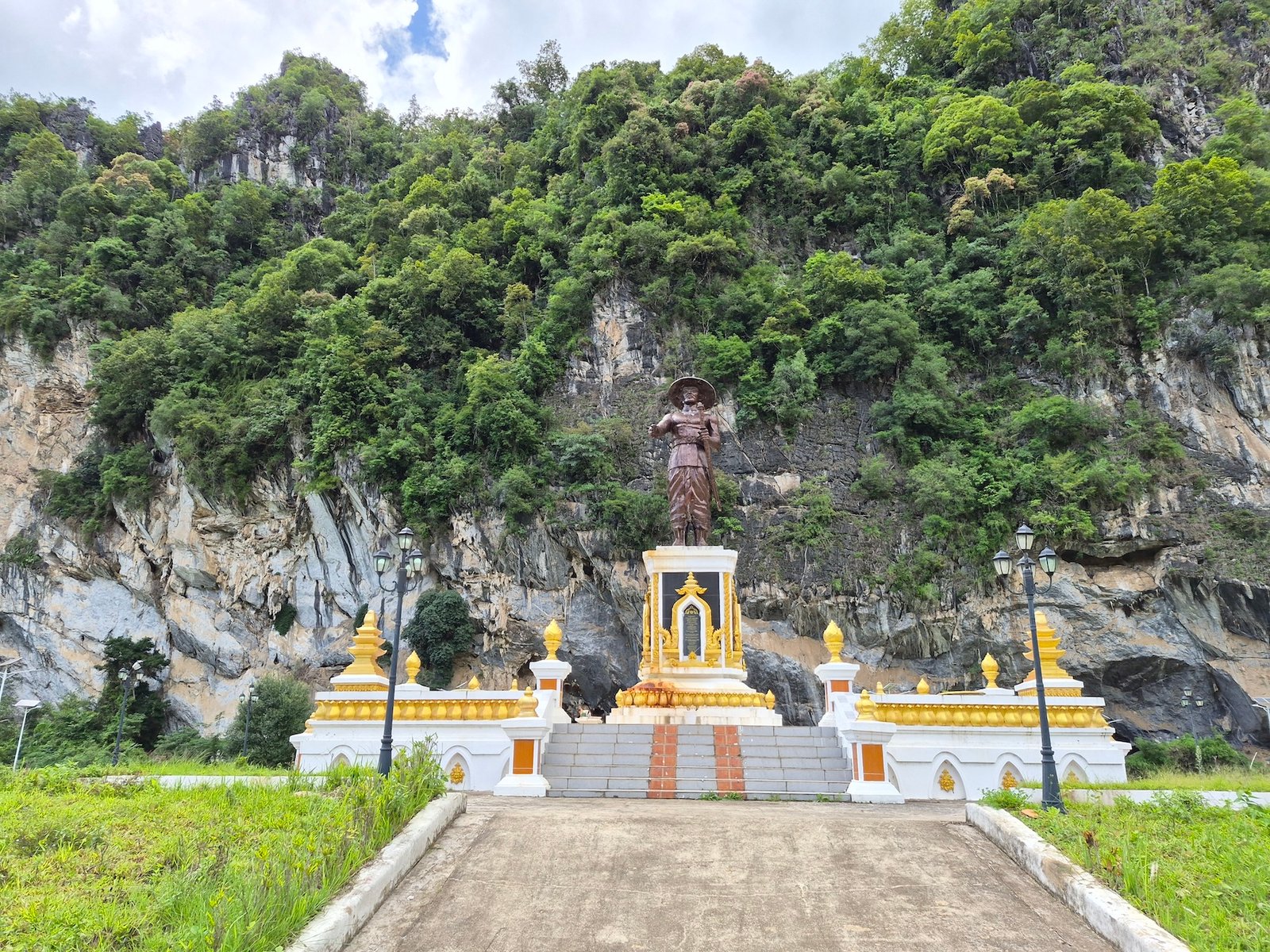
Chao Anouvong Cave is about four kilometers from Anouvong, on the road toward Wang Nam Kiew. There’s a large parking area, statues of Laos’ different ethnic groups, and a statue of King Anouvong in front of the cave.
King Anouvong was the last king of the Kingdom of Vientiane. He led a rebellion against Siamese rule between 1826 and 1828. According to local history from Tourism Laos, he used this cave to hide while escaping the Siamese army.
Google Maps also shows a spot called Phou Bia Viewpoint No. 1 not far from Anouvong. Don’t treat it as a normal roadside stop. Access to the Phou Bia area is controlled, and you usually need permission from the authorities in Anouvong, sometimes with a guide.
On top of that, Phou Bia is currently closed after heavy rain damaged the access road in August 2026. Check the current situation in Anouvong before you try to go there.
Anouvong, the capital of Xaysomboun Province, shows up as Ban Mouang Cha on Google Maps. As of September 2026, we could only find one higher-priced hotel called “Resort by Allpoints” listed on Agoda. Everything else is a simple, locally run guesthouse with no online booking at all.
So just do it the old-school Lao way: find a guesthouse on Google Maps, show up, and ask to see a room. Rates run roughly 250,000 to 550,000 LAK per night, and we had no trouble finding a room when we arrived.
We stayed at Phousy 2 Guesthouse Xaysomboun Province, a simple, clean place with friendly owners. Our air-conditioned room cost about 300,000 LAK per night in June 2026. It’s centrally located too, with a good restaurant and coffee shop right across the road.
💵 Cash: Anouvong has several ATMs, including BCEL, so getting Lao kip in town is easy. We’ve found Wise to be one of the most reliable ways to withdraw money in Laos. Still, carry enough cash once you leave Anouvong, since ATMs get scarce fast outside town. Our Money in Laos guide covers ATM fees, exchange rates and payment methods in more detail.
⛽ Fuel: There are several gas stations in Anouvong, so it’s easy to fill up before heading to Phou Hua Lon or exploring further. You can usually pay with cash or Lao QR, though we’d never fully rely on mobile payments once you’re off the main roads. Our Laos Expat Guide explains how Lao QR payments actually work.
📱Mobile signal: Both Unitel and Lao Telecom worked well for us. We carried SIM cards from both and had a solid signal around Anouvong and Phou Hua Lon, though reception can disappear on the more remote mountain roads. Our Laos SIM card guide covers where to buy a SIM or eSIM and which network to pick.
🛒 Minimart: Before driving up Phou Hua Lon, you’ll buy your entrance ticket at a small local minimart. It also sells water, Beerlao, soft drinks and basic snacks, so it’s the best place to stock up before heading onto the mountain.
🗑️ Garbage: Please don’t leave any rubbish on the hills. There are a few bins around the main area, but taking your waste back to town is even better. The elderly Lao landowner puts real effort into keeping Phou Hua Lon clean. Respect his land, support the small shop, and make sure no bottles, cans or plastic get left behind on the ridges.
Plan for at least two nights in Xaysomboun Province. That’s enough time to visit Phou Hua Lon without rushing, plus explore a few other spots around Anouvong. Here’s how we’d structure it.
Day 1: Arrive in Anouvong
After checking into your guesthouse, head up to Neng Ye Lor Viewpoint in the late afternoon. The hike is short but steep, around 15 to 20 minutes, and the view over Anouvong and the surrounding mountains is a great first taste of the region.
Day 2: Phou Hua Lon and Anouvong Highlights
Drive up to Phou Hua Lon early in the morning for the best chance at mist and clouds between the peaks. Once you’ve explored the grassy ridges, head back to town and continue on to Chao Anouvong Cave and Wang Nam Kiew, where you can relax over lunch in one of the bamboo huts by the river.
Day 3: Departure or Continue to Long Tieng
After two nights, you can head on toward Vientiane, Paksan or Phonsavan. If you have a spare day, consider adding Long Tieng, also known as Long Cheng. This remote town was once the center of the CIA-backed Secret War operation, and the old airstrip and General Vang Pao’s former house and headquarters are still there.
Long Tieng is several hours from Anouvong, and rough roads can slow you down. We ended up skipping it on this trip, so we can’t give you a first-hand route report. If you do go, plan a full extra day and overnight stay for it rather than treating it as a quick detour.
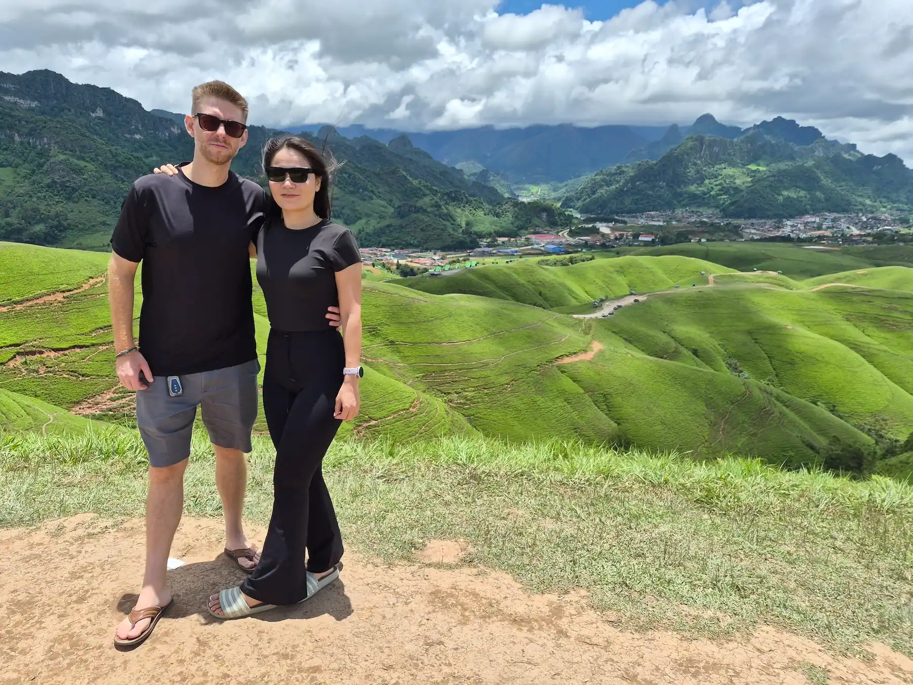
Absolutely. Phou Hua Lon is one of the most beautiful mountain destinations we’ve visited in Laos, and easily one of the country’s best viewpoints. Also we found Xaysomboun to be the most beautiful province in Laos! The rolling grasslands look nothing like the forested mountains and limestone formations you’ll find elsewhere in Laos, yet the mountain itself is surprisingly easy to reach once you’re in Anouvong.
Getting into Xaysomboun takes time, but that’s part of what makes it special. There are no tour buses here, no international hotel chains, no crowded viewpoints. Just quiet roads, dramatic scenery, and exactly the kind of Laos we set out to find when we first drove up here ourselves.
Spend at least two nights in Anouvong, visit Phou Hua Lon early in the morning, and leave time for the province’s other viewpoints, rivers and historical sites. If you like remote places and traveling off the usual route, Xaysomboun is absolutely worth the trip.
Phou Hua Lon is just outside Anouvong, in Xaysomboun Province, central Laos. The drive from central Anouvong to the mountain takes about five to ten minutes.
About 220 kilometres. The recommended route via Thabok and Phou Khao Khouay National Park usually takes five to six hours, depending on weather and road conditions.
Not usually, if you take the route through Thabok and Phou Khao Khouay, especially in dry conditions. The rougher inland route through Borikham and Thathom should only be attempted with a proper 4WD or in rainy season.
No. A sealed road leads almost to the parking area near the main viewpoint. From there, you can follow clear paths along the grassy ridges and decide how far you want to walk.
Late October to January is best overall, when the hills are often still green and rainfall is lower. May to September is the greenest but rainiest, while February to April is drier but browner, with more smoke in the air.
Yes. A few simple bungalows are available for around 350,000 LAK per night, and camping is possible too. They can’t be booked online yet, so check availability directly at the mountain.
Buses and shared minivans can get you to Anouvong, but they don’t usually continue to Phou Hua Lon itself. From town, you’ll need a local driver, an accommodation transfer, or a motorbike.
Disclosure: This article contains affiliate links. If you make a purchase through them, we may earn a small commission and you support our blog to write more helpful articles – at no extra cost to you.